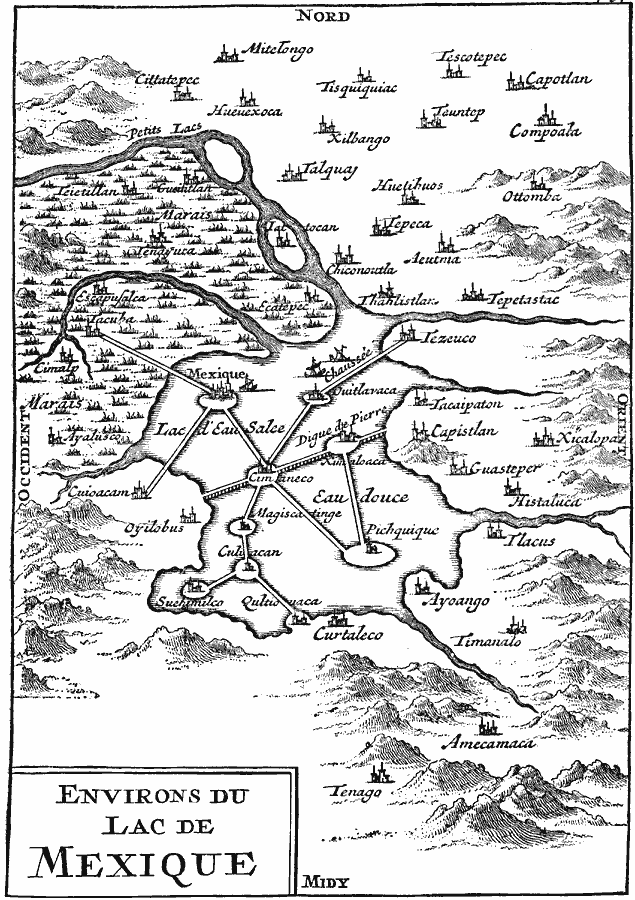
Description: A map from the book ‘Voyages de François Coreal aux Indes Occidentales’ (Amsterdam, 1722) showing the environs of the Lake of Mexico (Lake Texcoco or Lago Texcoco, sometimes called Tezcuco), including islands and causeways, marshlands, mountains, rivers, and neighboring cities. The architecture and ship types shown are European.
Place Names: Mexico, Mexico Cit
ISO Topic Categories: location,
inlandWaters,
oceans,
transportation
Keywords: The Lake of Mexico, physical, �transportation, kEarlyMapsFacsimile, physical features, roads, location,
inlandWaters,
oceans,
transportation, Unknown, 1722
Source: Justin Winsor, Narrative and Critical History of America Vol 1 (New York, NY: Houghton, Mifflin, and Company, 1889) 145
Map Credit: Courtesy the private collection of Roy Winkelman |
|