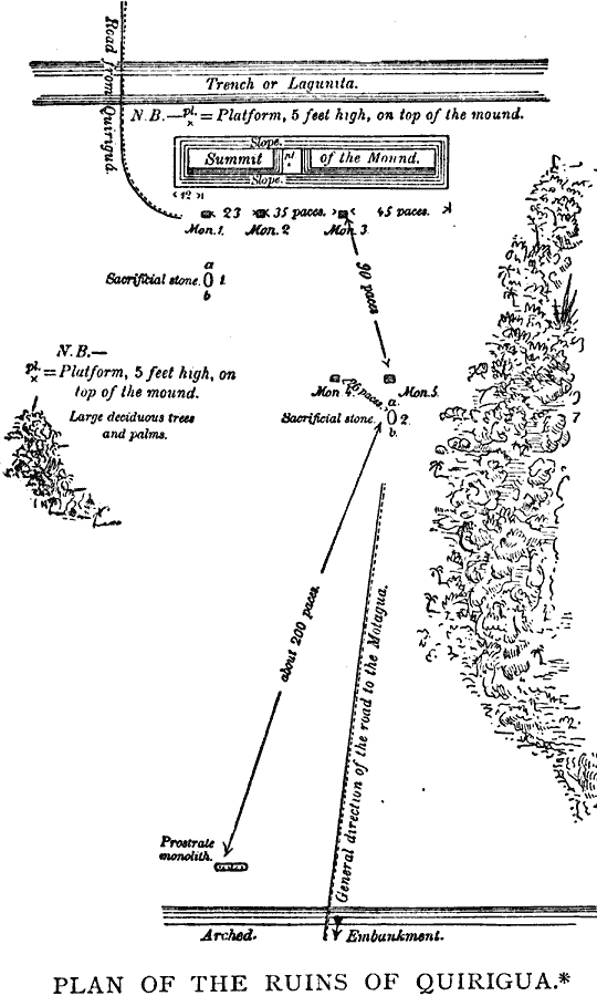
Description: A plan from the works of Meye and Schmidt (1883) of the ancient Maya city of Quiriguá in southeastern Guatemala on the Montagua River not long after its rediscovery by Stephens and Catherwood (1840). The plan shows the platforms, mound, sacrificial stones, and stone monuments found at that time.
Place Names: Guatemala, Quirig
ISO Topic Categories: location
Keywords: Ruins of Quirigua, physical, �transportation, �political, physical features, local jurisdictions, roads, location, Unknown, 1883
Source: Justin Winsor, Narrative and Critical History of America Vol 1 (New York, NY: Houghton, Mifflin, and Company, 1889) 196
Map Credit: Courtesy the private collection of Roy Winkelman |
|