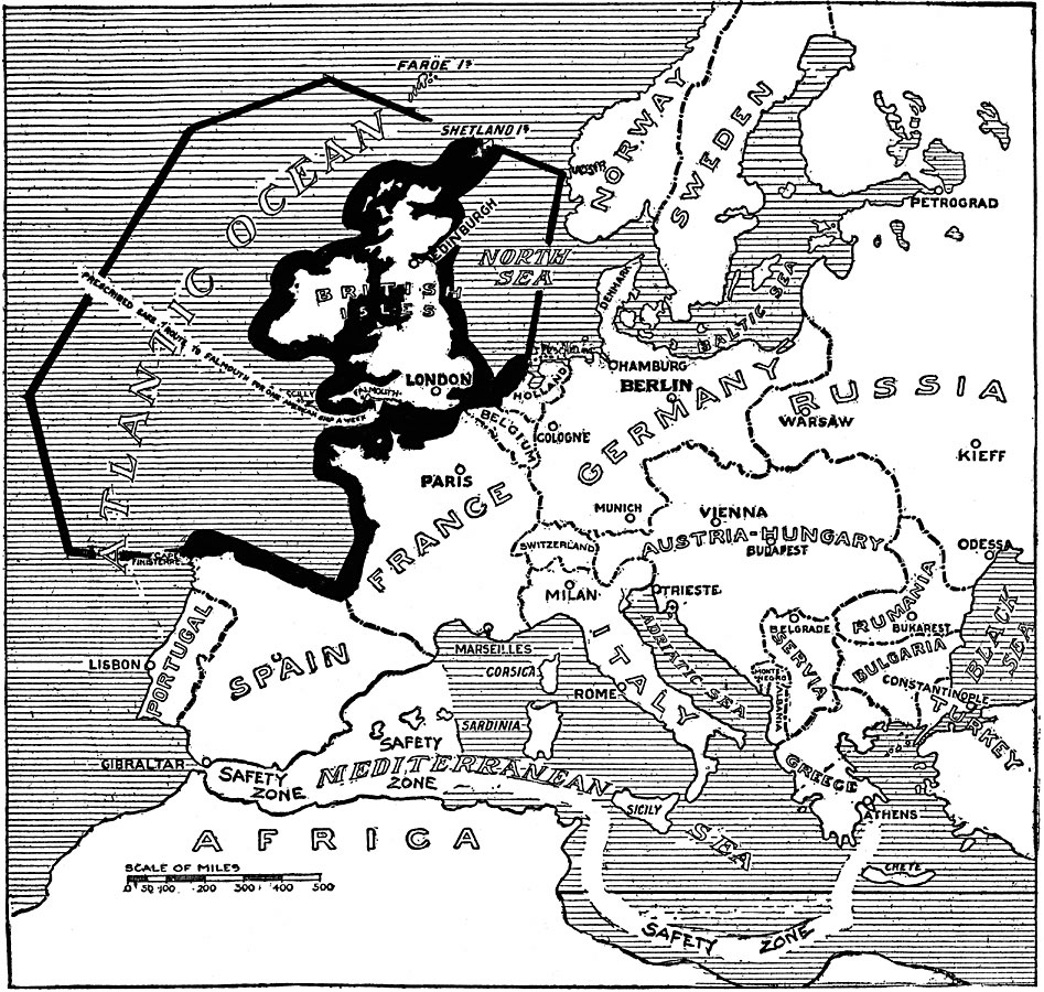
Description: A map of the "barred zones" and "safety lanes" outlined in Germany's 1917 note to the United States regarding neutral shipping to and from Europe. The barred zone includes the British Islands, and the coast from the Dutch Terscheilling Fireship, along the French coast, to Cape Finisterre in Spain. Within the barred zone is a prescribed safe route to Falmouth England for one American ship per week. In the Mediterranean, the safe zone is indicated for neutral ships from the Atlantic to the Greek territorial waters.
Place Names: A Complete Map of Europe, Germany, �France, �Greece, �Italy, �Portugal, �Romania, �Spain, �Sweden, �United Kingdom, �Bulgaria, �Serbia, �Austria-Hungary, �Norwa
ISO Topic Categories: location,
oceans,
intelligenceMilitary
Keywords: Barred and Safety Zones, historical, �physical, �political, kTransportation, kWWI, country borders, WWI, location,
oceans,
intelligenceMilitary, Unknown, 1917
Source: Willis J. Abbot, The United States in the Great War (New York, NY: Leslie-Judge Co., 1920) 4
Map Credit: Courtesy the private collection of Roy Winkelman |
|