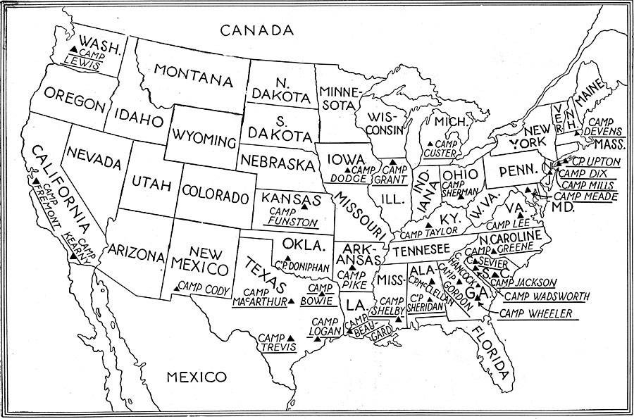
Description: A map from 1920 of the United States showing the main U. S. Army camps during World War I (1914–1919).
Place Names: A Complete Map of the United States,
ISO Topic Categories: boundaries,
location,
intelligenceMilitary
Keywords: Army Camps in the United States, physical, �political, kWWI, physical features, major political subdivisions,
country borders, WWI, boundaries,
location,
intelligenceMilitary, Unknown, 1914–1919
Source: Willis J. Abbot, The United States in the Great War (New York, NY: Leslie-Judge Co., 1920) 38
Map Credit: Courtesy the private collection of Roy Winkelman |
|