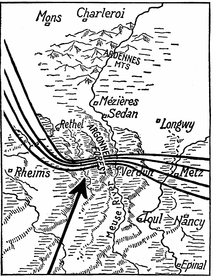
Description: A map showing the German lines around Verdun and the Argonne Forest in 1918. This map shows where the American Army broke through. Up until September 26, 1918, the German defense lines were as indicated by the heavy lines. In Belgium, Artois, and Champaigne, the first, second, third and fourth trench lines were considerable distances apart. In the Argonne sector, however, all four were practically together.
Place Names: France, Verdun, Metz, Rheims, Ardennes Mountains, Meuse River, Nancy
ISO Topic Categories: location,
inlandWaters,
intelligenceMilitary
Keywords: German Lines, physical, �historical, kWWI, physical features, WWI, location,
inlandWaters,
intelligenceMilitary, Unknown, 1918
Source: Willis J. Abbot, The United States in the Great War (New York, NY: Leslie-Judge Co., 1920) 130
Map Credit: Courtesy the private collection of Roy Winkelman |
|