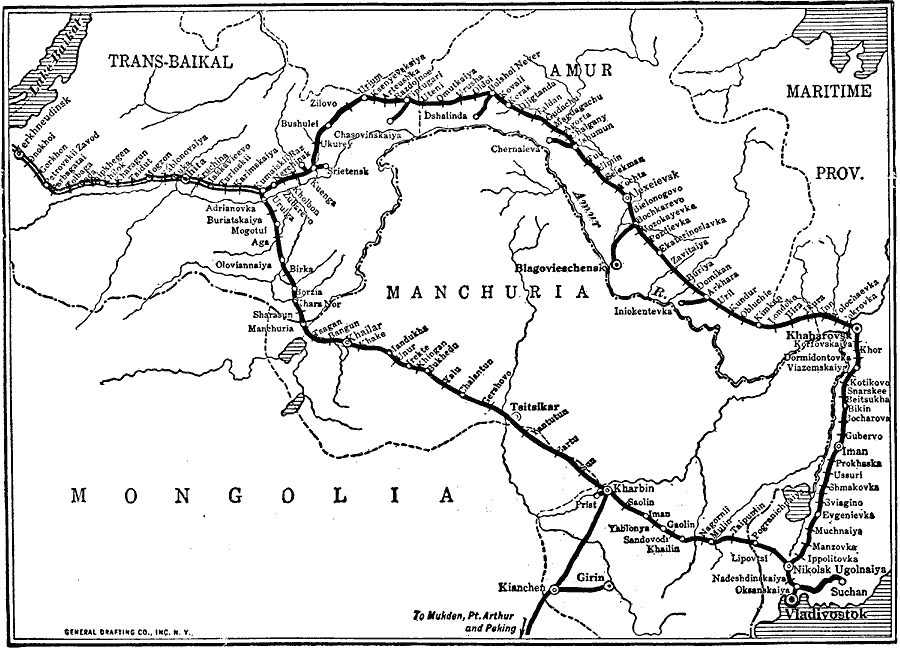
Description: A map from 1918 of the Trans-Siberian Railroad from Lake Baikal to Vladivostok on the Pacific. This section, except for Vladivostok and Kharbin (Harbin), was largely controlled by the Bolsheviki during World War I. The map shows the route of the trunk line from Lake Baikal to Chita and on to Kumaiskii Raz, where the trans–Manchurian junction separates from the Baikal Amur mainline. The map shows spur lines, railway stations, rivers, and the political boundaries of Mongolia and Manchuria in China, and the Trans–Baikal Oblast, Amur Oblast, and Maritime Provinces of Russia at the time.
Place Names: Northern Asia, Mongolia, �Russia, �Chin
ISO Topic Categories: transportation,
inlandWaters,
location,
oceans,
intelligenceMilitary
Keywords: Eastern Trans-Siberian Railroad, physical, �political, �transportation, physical features, major political subdivisions, railroads, WWI, transportation,
inlandWaters,
location,
oceans,
intelligenceMilitary, Unknown, 1918
Source: Willis J. Abbot, The United States in the Great War (New York, NY: Leslie-Judge Co., 1920) 174
Map Credit: Courtesy the private collection of Roy Winkelman |
|