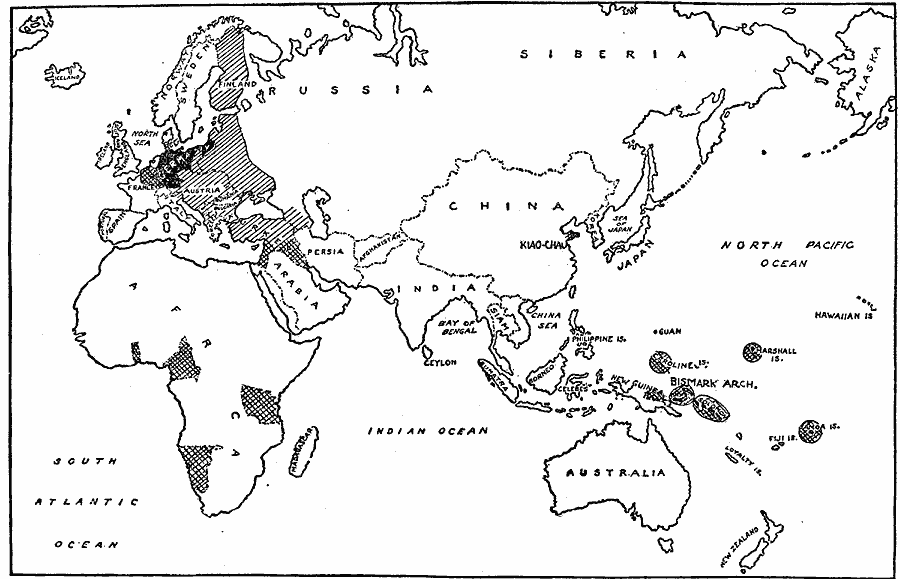
Description: A world map from 1919 showing the extent of German territories before and after WWI. The solid black area represents Germany under the peace treaty, the criss–cross shading indicates territory wrested from Germany by force of arms, and the single shading covers areas where German domination perished with her military defeat.
Place Names: Regional Miscellaneous, Africa, �Asia, �Europe, �Australi
ISO Topic Categories: physical, �political, �historical, kWorldEurasia, kWorldEuroAfrica, kWorldPacific
Keywords: Germany and Possessions Before and After Armistice, physical, �political, �historical, physical features, country borders, WWI, physical, �political, �historical, kWorldEurasia, kWorldEuroAfrica, kWorldPacific, Unknown, 1919
Source: Willis J. Abbot, The United States in the Great War (New York, NY: Leslie-Judge Co., 1920) 300
Map Credit: Courtesy the private collection of Roy Winkelman |
|