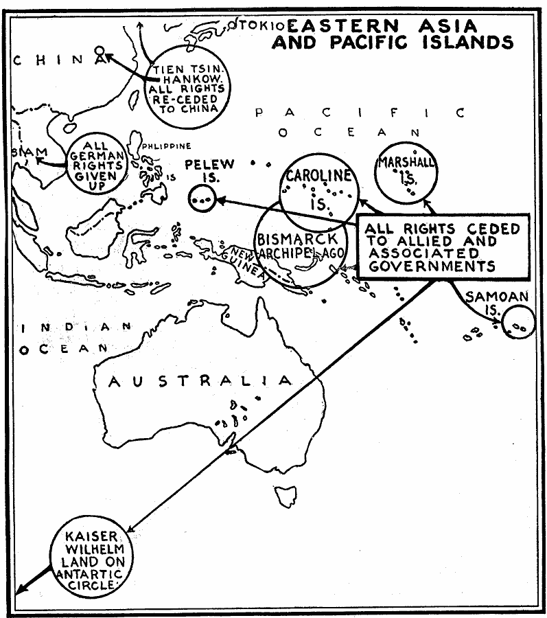
Description: A map from 1919 showing the German territorial possessions in Asia and the Pacific ceded to the Allies and associated governments at the end of WWI. The map shows the former territories of Tien Tsin (Tianjin) and Hankow (Hankou) China, Siam (Thailand), the Bismarck Archipelago, Kaiser Wilhelm Land on the Antarctic Circle, and the island groups of Pelew (Palau), Caroline, Marshall, and Samoa.
Place Names: Regional Pacific Ocean, Samoa, �Bismarck Archipelago, �Phillipines, �Siam, �China, �Japan, �Marshal Island
ISO Topic Categories: physical, �political, kWorldPacific, kWorldEurasia
Keywords: German Surrenders in Asia and the Pacific, physical, �political, physical features, country borders, physical, �political, kWorldPacific, kWorldEurasia, Unknown, 1919
Source: Willis J. Abbot, The United States in the Great War (New York, NY: Leslie-Judge Co., 1920) 307
Map Credit: Courtesy the private collection of Roy Winkelman |
|