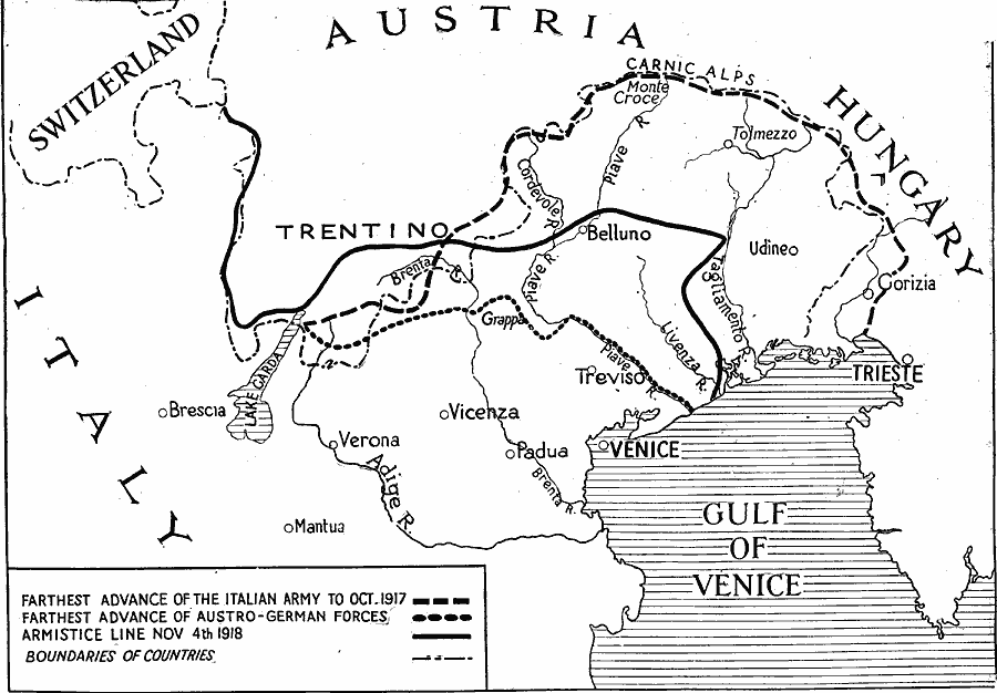
Description: A map showing the farthest advances of the Italian and Austro–German armies during WWI, and the armistice line.
Place Names: Italy, Italy, �Austria, �Hungary, �Switzerlan
ISO Topic Categories: boundaries,
transportation,
inlandWaters,
location,
intelligenceMilitary
Keywords: Advances in Northern Italy, historical, �physical, �political, kWWI, physical features, country borders, WWI, boundaries,
transportation,
inlandWaters,
location,
intelligenceMilitary, Unknown, 1917–1918
Source: Willis J. Abbot, The United States in the Great War (New York, NY: Leslie-Judge Co., 1920) last page
Map Credit: Courtesy the private collection of Roy Winkelman |
|