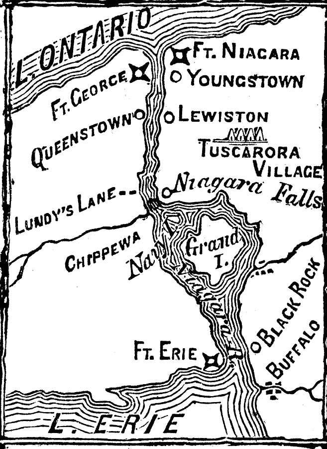
Description: The Niagara frontier during the War of 1812 showing forts and battle sites.
Place Names: New York, Lewiston, �Niagara Falls, �Ft. Niagar
ISO Topic Categories: intelligenceMilitary,
inlandWaters,
location
Keywords: Niagara Frontier, historical, �war of 1812, other military, intelligenceMilitary,
inlandWaters,
location, Unknown, 1815
Source: Frank Gilbert, The World: Historical and Actual (Chicago, IL: National Library Association, 1892) 519
Map Credit: Courtesy the private collection of Roy Winkelman |
|