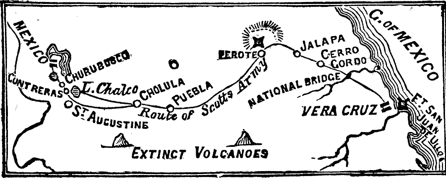
Description: A map of the area between Mexico City and Vera Cruz showing the route of General Scott during his campaign in the Mexican–American War (1847). The map shows the battle sites, including the siege of Fort San Juan de Ulloa and Vera Cruz, and the Battle of Cerro Gordo, and the route to Puebla, Cholula, St. Augustine, Contreras, and Mexico City.
Place Names: Mexico, Veracruz, �Mexico Cit
ISO Topic Categories: oceans,
location,
inlandWaters,
intelligenceMilitary
Keywords: Route of the U.S. Army in the Mexican-American War, physical, �historical, �mexican-american war, �mexican war, physical features, other military, oceans,
location,
inlandWaters,
intelligenceMilitary, Unknown, 1846–1848
Source: Frank Gilbert, The World: Historical and Actual (Chicago, IL: National Library Association, 1892) 526
Map Credit: Courtesy the private collection of Roy Winkelman |
|