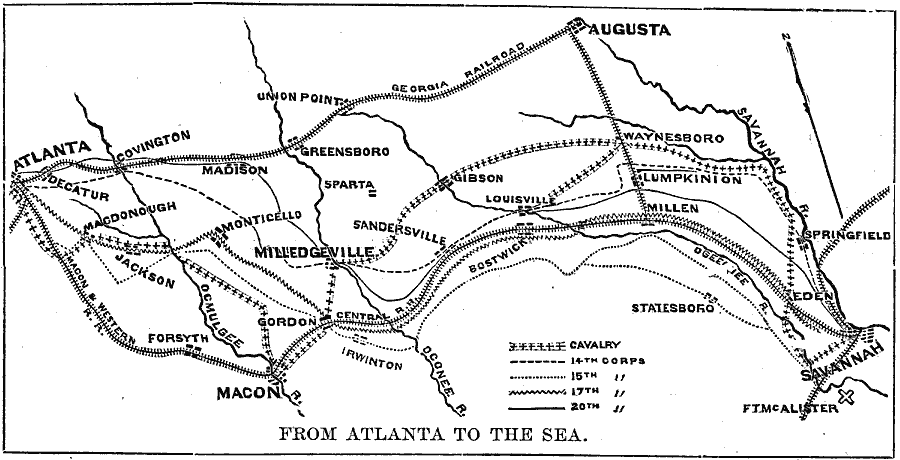
Description: A map showing the route of General Sherman's Savannah Campaign or "March to the Sea" (1864) during the American Civil War. The map is keyed to show the routes of the cavalry and infantry corps, railroads, and battle sites.
Place Names: Georgia, Atlanta, �Augusta, �Savannah, �Maco
ISO Topic Categories: inlandWaters,
location,
intelligenceMilitary
Keywords: From Atlanta to the Sea, physical, �historical, physical features, Civil War, inlandWaters,
location,
intelligenceMilitary, Unknown, 1864
Source: Frank Gilbert, The World: Historical and Actual (Chicago, IL: National Library Association, 1892) 545
Map Credit: Courtesy the private collection of Roy Winkelman |
|