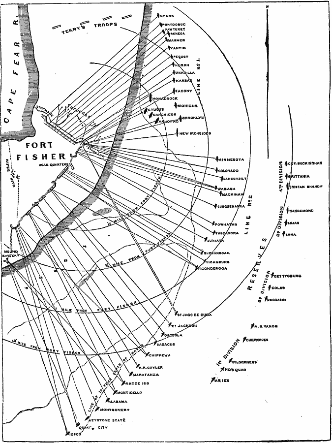
Description: A map showing the bombardment and Second Battle of Fort Fisher (January 13–15, 1865), in which Union forces successfully captured the fort. The map shows the Union ship and troop positions with bombardment ranges.
Place Names: North Carolina, Fort Fishe
ISO Topic Categories: location,
oceans,
structure
Keywords: Bombardment of Fort Fisher, physical, �historical, kBattle, physical features, Civil War, location,
oceans,
structure, Unknown, 1865
Source: Frank Gilbert, The World: Historical and Actual (Chicago, IL: National Library Association, 1892) 559
Map Credit: Courtesy the private collection of Roy Winkelman |
|