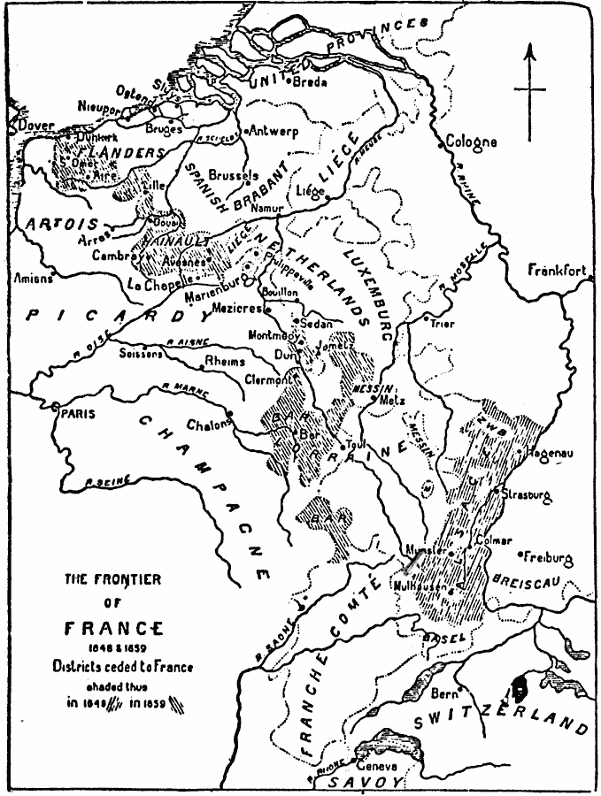
Description: A map of the northern French frontier showing the districts ceded to France under the Peace of Westphalia in 1648 (Alsace) and the Treaty of the Pyrenees in 1659 (western portion of Flanders, Lille, Hainault, and Bar).
Place Names: France, Dunkerque, �Pari
ISO Topic Categories: oceans,
inlandWaters,
location,
boundaries
Keywords: The Frontier of France, physical, �political, physical features, country borders, oceans,
inlandWaters,
location,
boundaries, Unknown, 1648–1659
Source: Day Otis Kellogg, The Encyclopedia Britannica Vol 9 (New York, NY: The Werner Company, 1903) 572
Map Credit: Courtesy the private collection of Roy Winkelman |
|
