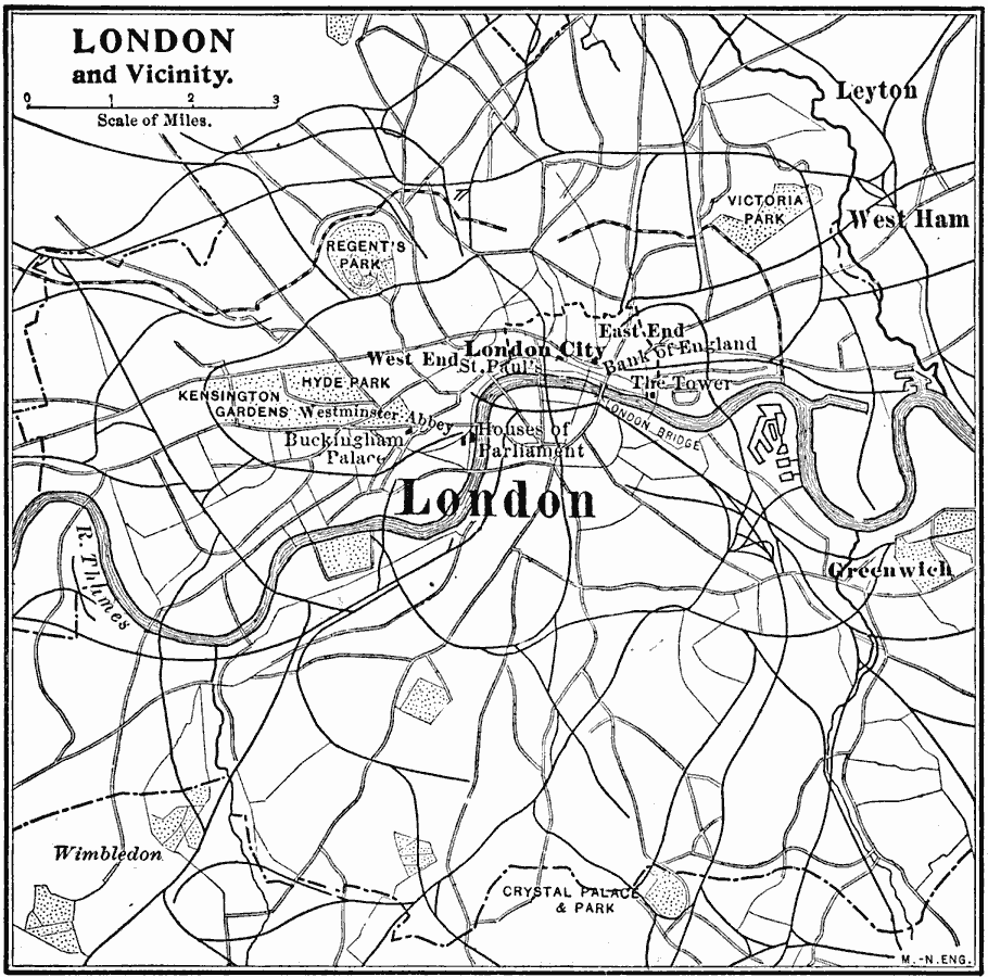
Description: A sketch map of London and the surrounding vicinity around 1909, showing the city boundaries, major roads, railways, parks, and the landmarks of Regent's Park, Victoria Park, Kensington Garden, Hyde Park, Buckingham Palace, Westminster Abby, St. Paul's, House of Parliament, Bank of England, London Bridge, The Tower, Wimbledon, and Crystal Palace. This map also shows the neighboring cities of West Ham and Greenwich.
Place Names: United Kingdom, London, �Greenwich, �West Ha
ISO Topic Categories: transportation,
structure,
location,
inlandWaters
Keywords: London and Vicinity, physical, �political, �transportation, physical features, local jurisdictions, roads, transportation,
structure,
location,
inlandWaters, Unknown, 1909
Source: Charles F. King, Elementary Geography (New York, NY: Charles Scribner's Sons, 1909) 168
Map Credit: Courtesy the private collection of Roy Winkelman |
|