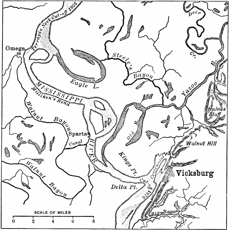
Description: A map from 1916 of the vicinity of Vicksburg showing typical river meandering of the Mississippi River, including remnant river beds and oxbow lakes (Eagle Lake).
Place Names: Mississippi, Vicksburg, �Omega, �Spart
ISO Topic Categories: location,
inlandWaters,
transportation
Keywords: Meanders in the Mississippi River, physical, �political, �transportation, physical features, local jurisdictions, water routes, location,
inlandWaters,
transportation, Unknown, 1916
Source: Albert Perry Brigham & Charles T. McFarlane, Essentials of Geography (New York, NY: American Book Company, 1916) 14
Map Credit: Courtesy the private collection of Roy Winkelman |
|