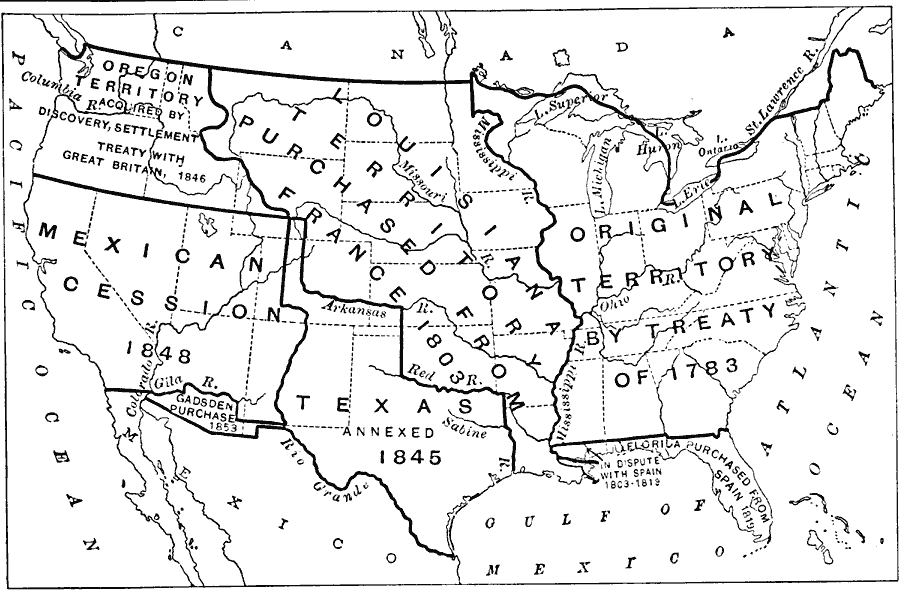
Description: A map of the United States showing the growth of the nation from 1783 to1853. The map shows the thirteen original states and the territories acquired in 1783, the Louisiana Purchase from France in 1803, Florida purchased from Spain in 1819, the Texas annexation in 1845, the Oregon Country acquired by the treaty with Great Britain in 1846, the Mexican cession of western territories in 1848, and the Gadsden Purchase in northern Mexico in 1853.
Place Names: Growth of Nation,
ISO Topic Categories: boundaries,
location,
oceans,
inlandWaters
Keywords: Acquisitions of US Territory, physical, �political, �historical, physical features, country borders,
major political subdivisions, historical event, boundaries,
location,
oceans,
inlandWaters, Unknown, 1783–1853
Source: Albert Perry Brigham & Charles T. McFarlane, Essentials of Geography (New York, NY: American Book Company, 1916) 47
Map Credit: Courtesy the private collection of Roy Winkelman |
|