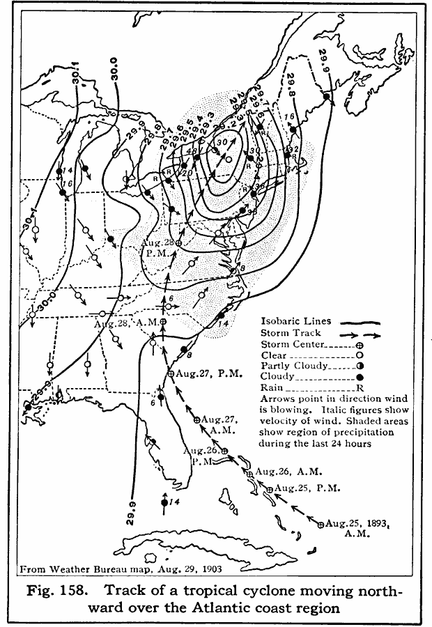
Description: A weather map from 1893 showing the northward progression of a tropical cyclone in August of 1893. The map is keyed to show the isobars over the event, the direction of the storm, storm center, areas of clear weather, areas of partly cloudy weather, areas of cloudy weather, and rain. The map shows wind direction and velocity.
Place Names: Meteorology, cyclones, �hurricane
ISO Topic Categories: climatologyMeteorologyAtmosphere,
oceans,
location,
inlandWaters
Keywords: Track of a Cyclone, political, �meteorological, major political subdivisions, climatologyMeteorologyAtmosphere,
oceans,
location,
inlandWaters, Unknown, 1893
Source: Albert Perry Brigham & Charles T. McFarlane, Essentials of Geography (New York, NY: American Book Company, 1916) 102
Map Credit: Courtesy the private collection of Roy Winkelman |
|