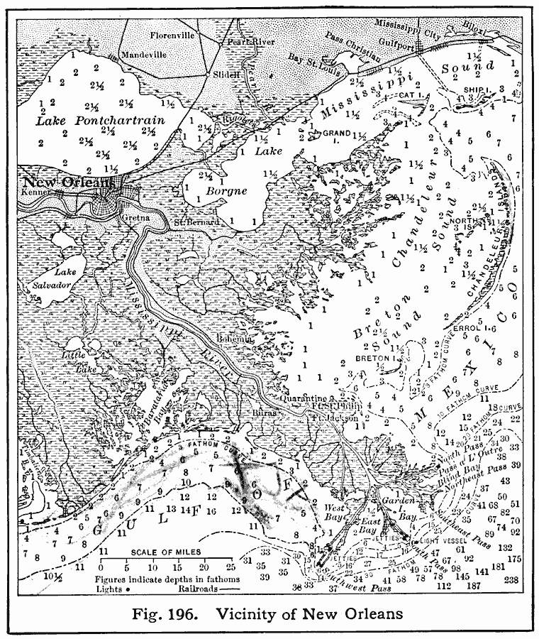
Description: A map from 1916 of the Mississippi River Delta from New Orleans and Lake Pontchartrain to the mouth of the river on the Gulf of Mexico. The map shows railroads, swamp lands, navigation lights, and water depths in fathoms. The 3, 10, 20, and 30 fathom contours are shown.
Place Names: Louisiana, New Orlean
ISO Topic Categories: boundaries,
location,
inlandWaters,
oceans,
transportation
Keywords: Vicinity of New Orleans, hydrological, �physical, �political, �transportation, physical features, local jurisdictions, railroads, water depths, boundaries,
location,
inlandWaters,
oceans,
transportation, Unknown, 1916
Source: Albert Perry Brigham & Charles T. McFarlane, Essentials of Geography (New York, NY: American Book Company, 1916) 126
Map Credit: Courtesy the private collection of Roy Winkelman |
|