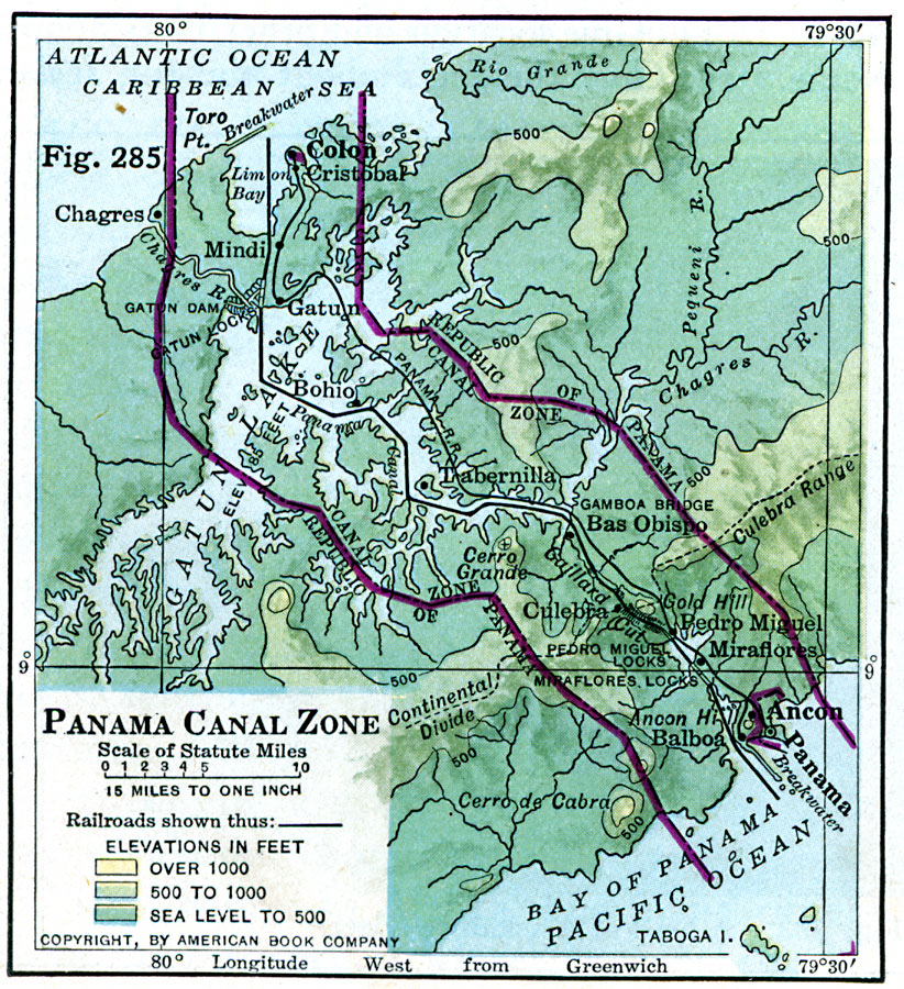
Description: A map from 1916 of the Panama Canal Zone showing the physical features of the area, including terrain and mountains, rivers, lakes, the continental divide, and coastal features. The map uses color–contouring to show elevations from sea level to 500 feet in dark green, 500 to 1000 feet in light green, and over 1000 feet in buff tint. The map also shows the boundaries between the Canal Zone and the Republic of Panama, the Panama Railroad, dams and locks, and towns in the area.
Place Names: Panama Canal Zone, Colon, �Cristoba
ISO Topic Categories: boundaries,
location,
inlandWaters,
oceans,
transportation
Keywords: Panama Canal Zone, physical, �transportation, �political, physical features, local jurisdictions, water routes, boundaries,
location,
inlandWaters,
oceans,
transportation, Unknown, 1916
Source: Albert Perry Brigham & Charles T. McFarlane, Essentials of Geography (New York, NY: American Book Company, 1916) 190
Map Credit: Courtesy the private collection of Roy Winkelman |
|