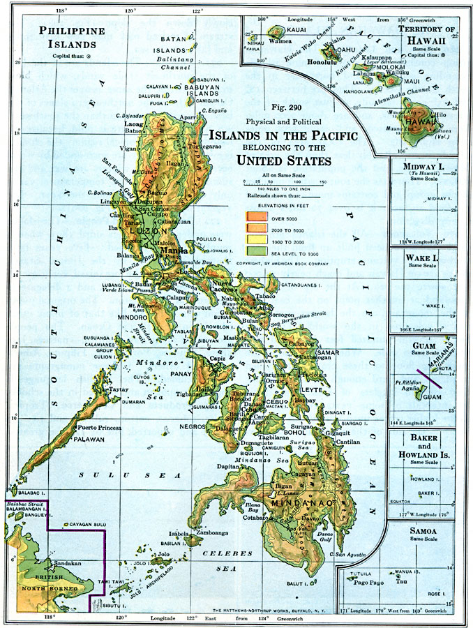
Description: A map showing the American possessions and territorial claims in the Pacific in 1916. The map details the Philippine Islands with the boundary of the British North Borneo territory, the territory of Hawaii, Midway Island, Wake Island, Guam, Baker and Howland islands, and Samoa. The map is color–coded to show general elevations from sea level to above 5000 feet, with mountain systems and prominent volcanoes and peaks shown with elevations given in feet above sea level. Major cities, towns, and ports, railroads, rivers, terrain, and coastal features are shown.
Place Names: Regional Pacific Ocean, Asia, �North Americ
ISO Topic Categories: physical, �transportation, kWorldPacific
Keywords: American Islands in the Pacific, physical, �transportation, physical features, railroads, physical, �transportation, kWorldPacific, Unknown, 1916
Source: Albert Perry Brigham & Charles T. McFarlane, Essentials of Geography (New York, NY: American Book Company, 1916) 194
Map Credit: Courtesy the private collection of Roy Winkelman |
|