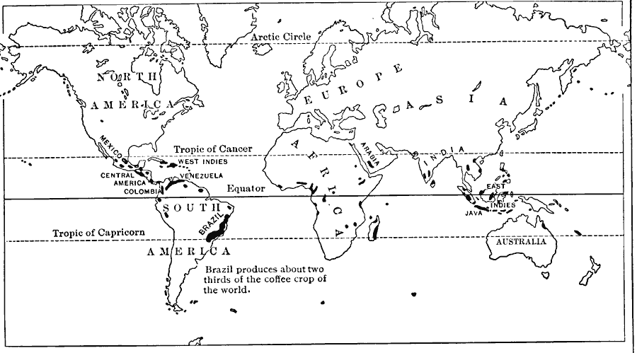
Description: A world map from1916 showing the principal coffee–producing regions of the world at the time. "Coffee, like cotton, is raised in warm countries. The plant is said to have derived its name from Kaffa, in Abyssinia, but it was first extensively cultivated in Arabia, where Mocha (the present Mokha) gave its name to a superior kind of coffee. In 1690 a Dutchman from Holland took some of the plants to the island of Java. Later, coffee plants were carried to the West Indies, to Brazil, and to the Philippine Islands. Brazil now grows two thirds of the world's supply of coffee, but the crop is important also in Venezuela, Columbia, Central America, Mexico, and the islands of Haiti and Porto Rico. In the Old World coffee is grown in the East Indies, British India, Arabia, and East Africa."
Place Names: A Complete Map of Globes and Multi-continent, Antarctica, �Africa, �Asia, �Australia, �Europe, �North America, �South Americ
ISO Topic Categories: farming,
location,
oceans
Keywords: Coffee Production, physical, �statistical, kAgriculture, physical features, agriculture, farming,
location,
oceans, Unknown, 1916
Source: Albert Perry Brigham & Charles T. McFarlane, Essentials of Geography (New York, NY: American Book Company, 1916) 227
Map Credit: Courtesy the private collection of Roy Winkelman |
|