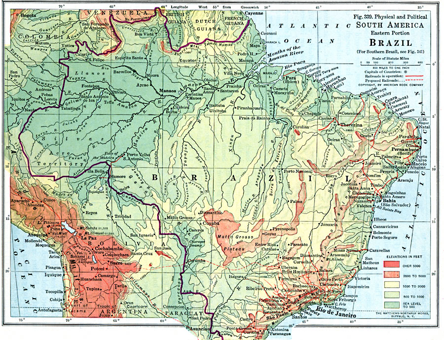
Description: A map from 1916 showing eastern Brazil with boundaries at the time. The map is contour–colored to show elevations fro sea level to above 5000 feet. The map coverage includes portions of the Guianas, Venezuela, Columbia, Peru, Chile, Bolivia, Paraguay, and Argentina. The map shows capitals, major cities and towns, existing and proposed railroads, rivers, terrain, and coastal features. Rio de Janeiro is shown as the capital of Brazil. "Brazil is more than five sixths as large as Europe, but Europe has about 455,000,000 people and Brazil only about 24,000,000 people. In Brazil there are on an average only seven or eight persons for each square mile. Portuguese is the chief language of the country. Most of the people live near the coast or in a few of the southern states, and much of the interior is almost uninhabited." — Brigham and McFarlane, 1916, p. 231
Place Names: Brazil, Venezuela, �Brazil, �Chile, �Paraguay, �Bolivia, �Argentin
ISO Topic Categories: boundaries,
location,
inlandWaters,
oceans,
transportation,
planningCadastre
Keywords: Eastern Brazil, physical, �political, �transportation, physical features, country borders, railroads, boundaries,
location,
inlandWaters,
oceans,
transportation,
planningCadastre, Unknown, 1916
Source: Albert Perry Brigham & Charles T. McFarlane, Essentials of Geography (New York, NY: American Book Company, 1916) 230
Map Credit: Courtesy the private collection of Roy Winkelman |
|