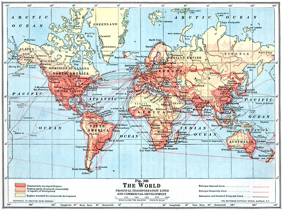
Description: A world map from 1916, showing principal transportation lines and levels of commercial development at the time. The map is color–coded to show commercially developed regions, regions partially developed or capable of becoming commercially developed, and regions unsuited for commercial development. The map shows major cities and trade centers, principal railroad lines (including proposed lines in Africa and Arabia), principal steamship routes, and submarine and overland telegraph lines.
Place Names: A Complete Map of Globes and Multi-continent, Africa, �Asia, �Australia, �North America, �South America, �Europ
ISO Topic Categories: utilitiesCommunication,
transportation,
boundaries,
inlandWaters,
location,
oceans
Keywords: Principal Transportation Lines and Commercial Development of the World, physical, �political, �statistical, �transportation, kEconomic, physical features, country borders, industry, water routes,
railroads, utilitiesCommunication,
transportation,
boundaries,
inlandWaters,
location,
oceans, Unknown, 1916
Source: Albert Perry Brigham & Charles T. McFarlane, Essentials of Geography (New York, NY: American Book Company, 1916) 248
Map Credit: Courtesy the private collection of Roy Winkelman |
|