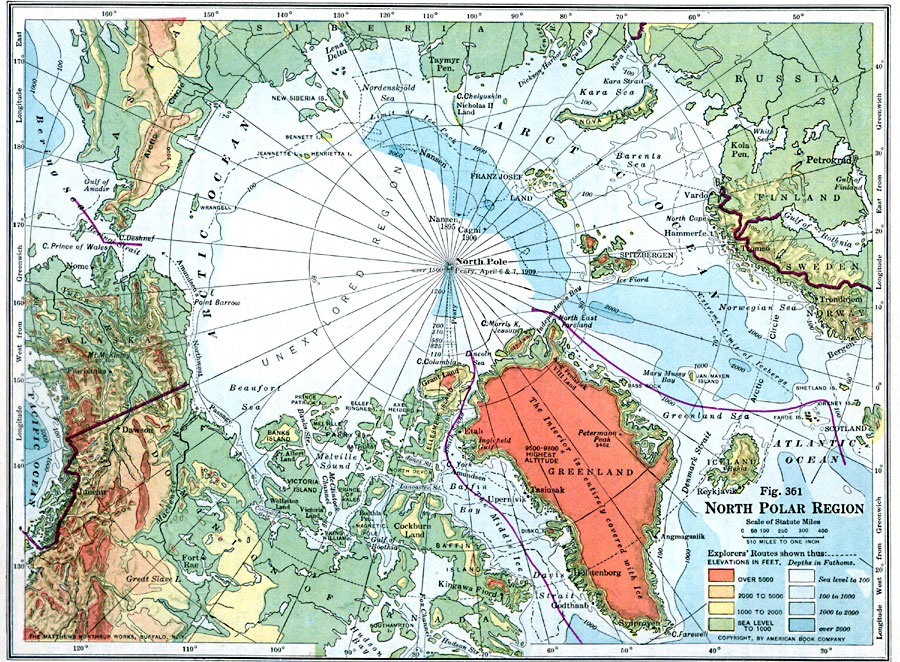
Description: A physical map of the North Polar region from 1916 showing the general elevations and depths, and the routes of polar exploration of Fridtjof Nansen (1893–1896), the northernmost point reached by Umberto Cagni (with the Duke of Abruzzi) in 1906, the route of Roald Amundsen's first crossing of the Northwest Passage, and the route of Commander Peary to the pole in 1909. The map uses contour coloring to show land elevations from sea level to over 5000 feet and depths from sea level to over 2000 fathoms. The elevations of prominent peaks in the region are given, as well as sounding depths along Peary's route. Major cities and outposts are shown, as well as rivers, lakes, terrain, coastal features, and the extreme limits of pack ice and icebergs.
Place Names: Arctic Region, Norway, Alaska, Greenland, Canada, Siberia, Russia, Finland, Sweden
ISO Topic Categories: boundaries,
oceans,
location,
inlandWaters
Keywords: North Polar Region, physical, �political, physical features, country borders, boundaries,
oceans,
location,
inlandWaters, Unknown, 1916
Source: Albert Perry Brigham & Charles T. McFarlane, Essentials of Geography (New York, NY: American Book Company, 1916) 250
Map Credit: Courtesy the private collection of Roy Winkelman |
|