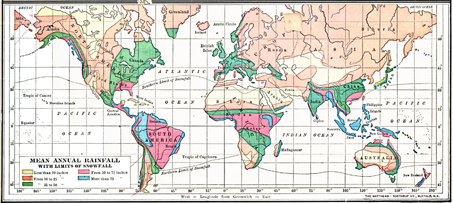
Description: A map from 1899 showing the mean annual rainfall throughout the world. This map is color–coded to show areas where the number of inches of rainfall ranges from below 10 inches to above 75 inches. Lines show the southern limits of snowfall in the northern hemisphere and northern limit in the southern hemisphere.
Place Names: A Complete Map of Globes and Multi-continent, Africa, �Antarctica, �Asia, �Australia, �Europe, �North America, �South Americ
ISO Topic Categories: oceans,
inlandWaters,
location,
climatologyMeteorologyAtmosphere
Keywords: Mean Annual Rainfall with Limits of Snowfall, meteorological, �physical, �rainfall, �snowfall, kClimate, physical features, climate,
rainfall, oceans,
inlandWaters,
location,
climatologyMeteorologyAtmosphere, Unknown, 1899
Source: Horace S. Tarbell, LL.D. , The Complete Geography (New York, NY: American Book Company, 1899) 11
Map Credit: Courtesy the private collection of Roy Winkelman |
|