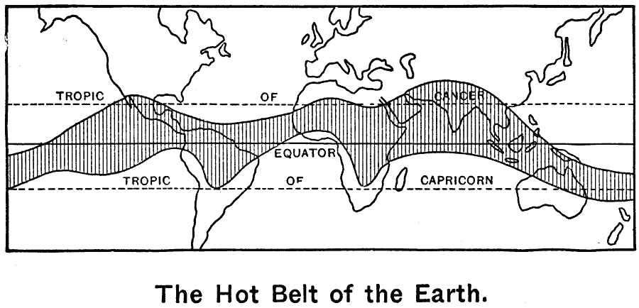
Description: A world map from 1899 showing the "Hot Belt," or the zone between the mean annual 80° isotherms. "There are many times more land north of the equator than south of it, and this land heats more readily than the ocean heats. From this it results that the hottest part of the earth is not just at the equator, as we might suppose, but six or seven hundred miles north of it. Here is a map of the hot belt of the earth. Notice how far north of the equator its center lies. That the land masses of South America, Africa, and Australia draw the hot belt southward is evident; and the effect of Mexico, northern Africa, and southern Asia is equally evident." — Tarbell, 1899, p. 24.
Place Names: A Complete Map of Globes and Multi-continent, Africa, �Antarctica, �Asia, �Australia, �Europe, �North America, �South Americ
ISO Topic Categories: oceans,
inlandWaters,
location,
climatologyMeteorologyAtmosphere
Keywords: Hot Belt of the Earth, climate, �meteorological, �physical, kClimate, physical features, climate, oceans,
inlandWaters,
location,
climatologyMeteorologyAtmosphere, Unknown, 1899
Source: Horace S. Tarbell, LL.D. , The Complete Geography (New York, NY: American Book Company, 1899) 12
Map Credit: Courtesy the private collection of Roy Winkelman |
|