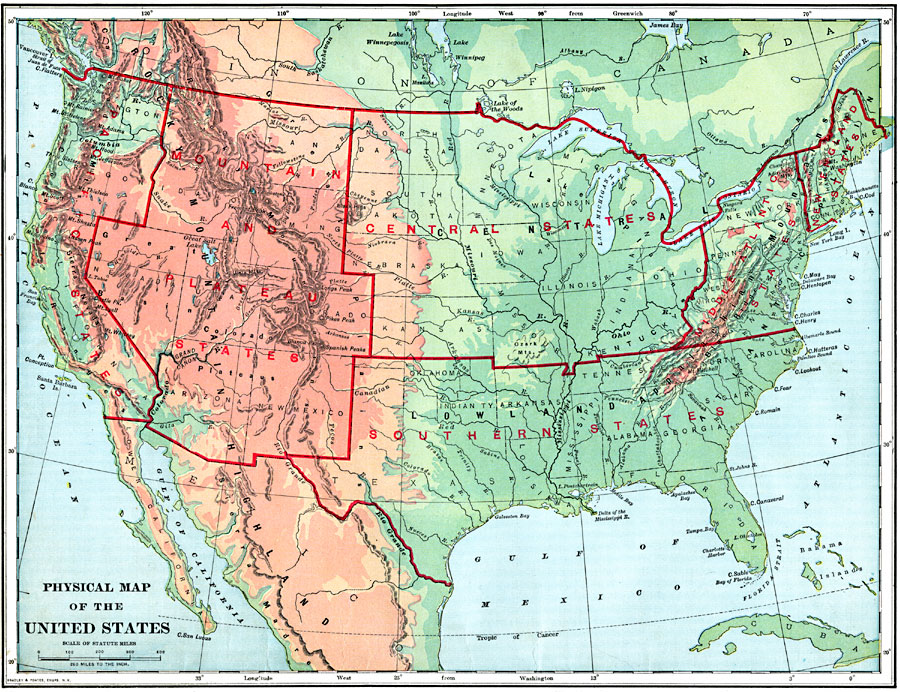
Description: A map from 1899 of the United States showing the physical features of the area, including mountain systems and highlands, plateaus, basins, plains, lakes, rivers, and coastal features. This map also shows the six conventional state divisions of New England States, Middle Atlantic States, Southern States, Central States, Mountain and Plateau States, and Pacific States.
Place Names: A Complete Map of the United States, central, �eastern, �middle Atlantic, �mountain, �New England, �Pacific, �plateau, �southern,
ISO Topic Categories: oceans,
inlandWaters,
location,
boundaries,
transportation
Keywords: The United States, borders, �physical, �topographical, �physical features,
topographical, country borders, oceans,
inlandWaters,
location,
boundaries,
transportation, Unknown, 1899
Source: Horace S. Tarbell, LL.D. , The Complete Geography (New York, NY: American Book Company, 1899) 34
Map Credit: Courtesy the private collection of Roy Winkelman |
|