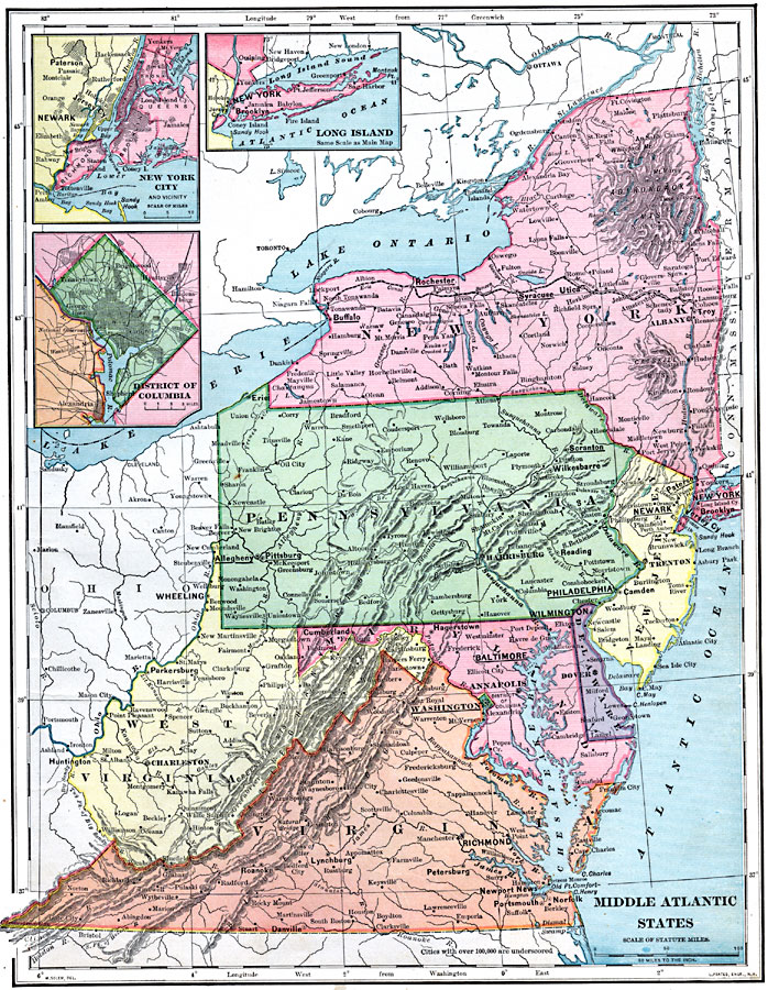
Description: A map from 1899 of the Middle Atlantic States (New York, New Jersey, Pennsylvania, Delaware, Maryland, Virginia, and West Virginia) showing State capitals, major cities (names of cities with populations over 100,000 are underlined), towns, mountains, lakes, rivers, and coastal features of the region. Inset maps detail Long Island, New York City and vicinity, and the District of Columbia.
Place Names: Atlantic States, Delaware, �Maryland, �New Jersey, �New York, �Pennsylvania, �Virginia, �Washington D.C., �West Virginia, �Middle Atlantic States, �Mid-Atlantic States, �New York Stat
ISO Topic Categories: oceans,
inlandWaters,
location,
boundaries,
transportation
Keywords: Middle Atlantic States, borders, �physical, �topographical, ��statistical, physical features,
topographical, country borders, population, oceans,
inlandWaters,
location,
boundaries,
transportation, Unknown, 1899
Source: Horace S. Tarbell, LL.D. , The Complete Geography (New York, NY: American Book Company, 1899) 39
Map Credit: Courtesy the private collection of Roy Winkelman |
|