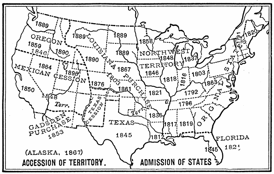
Description: A map from 1899 of the United States showing the growth of the nation from the original States in 1783 to the admission of Utah into the Union in 1896. The map shows the Northwest Territory claimed at the end of the American Revolutionary War, the Louisiana Purchase in 1803, the Oregon Country in 1846, Mexican cession in 1848, cession of Texas in 1850, the Gadsden Purchase in 1853, and purchase of Alaska in 1867.
Place Names: Growth of Nation, United States, �statehood, �admission to unio
ISO Topic Categories: oceans,
inlandWaters,
location
Keywords: Admission of States to the Union, physical, �historical, physical features, historical event, oceans,
inlandWaters,
location, Unknown, 1899
Source: Horace S. Tarbell, LL.D. , The Complete Geography (New York, NY: American Book Company, 1899) 64
Map Credit: Courtesy the private collection of Roy Winkelman |
|