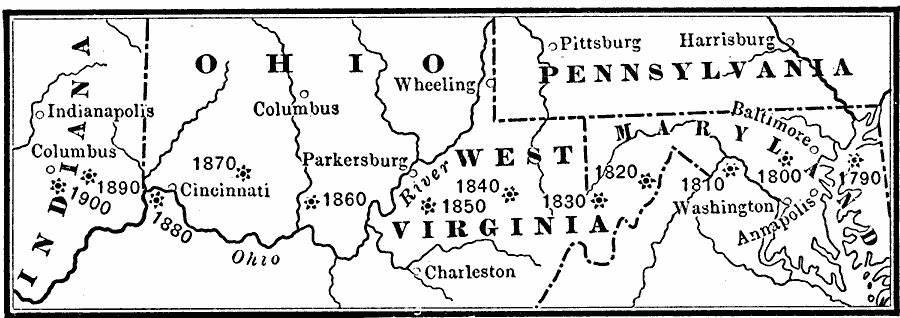
Description: Shows dates that states of Indiana, Maryland, Ohio, Pennsylvania, Washington D.C., and West Virginia were admitted to the Union.
Place Names: Demographics, Ohio, �West Virginia, �Virginia, �Kentucky, �Pennsylvania, �Indiana, �populatio
ISO Topic Categories: oceans,
inlandWaters,
location
Keywords: The Center of Population in the United States, physical, �historical, physical features, historical event, oceans,
inlandWaters,
location, Unknown, 1790–1900
Source: Henry Wark, ed. , Wark's Modern Educator (New York, NY: Henry Wark, 1904) 64
Map Credit: Courtesy the private collection of Roy Winkelman |
|