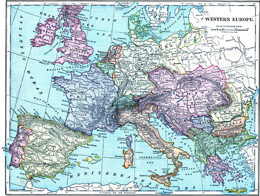
Description: A map from 1899 of Western Europe showing the political boundaries of Denmark, the British Isles, Netherlands, Belgium, Luxemburg, German Empire, Poland, Austria–Hungary, Switzerland, France (including Corsica), Portugal, Spain, Italy (including Sicily and Sardinia), Rumania, Servia, Montenegro, Bulgaria, European Turkey, Greece, and Crete. This map shown major cities, rivers, and mountain systems in the region.
Place Names: Western and Central Europe, Austria, �Bulgaria, �Denmark, �England, �France, �Germany, �Greece, �Hungary, �Ireland, �Italy, �Netherlands, �Portugal, �Rumania, �Sardinia, �Servia, �Spain, �Switzerland, �Turkey, �United Kingdo
ISO Topic Categories: oceans,
inlandWaters,
location
Keywords: Western Europe, borders, �topographical, �physical, kEuropeanOttomanEmpire, physical features,
topographical, country borders, oceans,
inlandWaters,
location, Unknown, 1899
Source: Horace S. Tarbell, LL.D. , The Complete Geography (New York, NY: American Book Company, 1899) 90
Map Credit: Courtesy the private collection of Roy Winkelman |
|