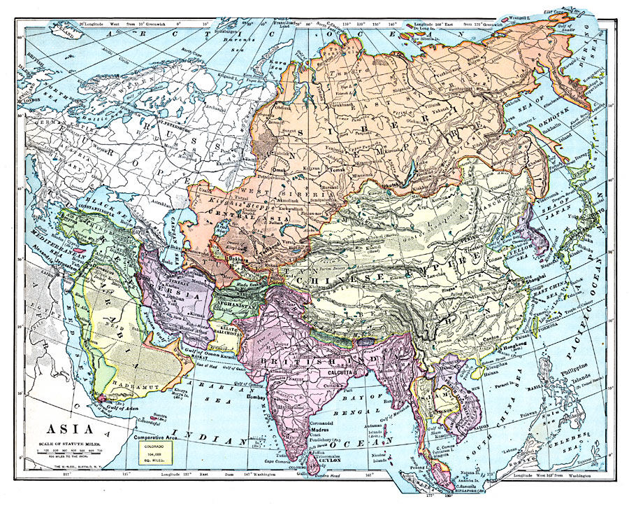
Description: A map of Asia from 1899 showing country boundaries at the time, foreign possessions, capitals and major cities, rivers, canals, lakes, deserts, terrain, and coastal features. This map shows the principal railways and caravan routes of the region with connections to Europe. The map shows the extent of the Russian Empire and Turkish Ottoman Empire in Asia, and the territories of Japan and the Chinese Empire at the time. An outline map of Colorado at the same map scale is included to show comparative area size.
Place Names: A Complete Map of Asia, Afghanistan, �Arabia, �British India, �Cambodia, �Ceylon, �China, �Hong Kong, �Japan, �Kabul, �Korea, �Malay Peninsula, �Philippine Islands, �Siam, �Siberia, �Sumatra, �Turke
ISO Topic Categories: oceans,
inlandWaters,
location
Keywords: Asia, borders, �topographical, �physical, kComparativeArea, physical features,
topographical, country borders, oceans,
inlandWaters,
location, Unknown, 1899
Source: Horace S. Tarbell, LL.D. , The Complete Geography (New York, NY: American Book Company, 1899) 106
Map Credit: Courtesy the private collection of Roy Winkelman |
|