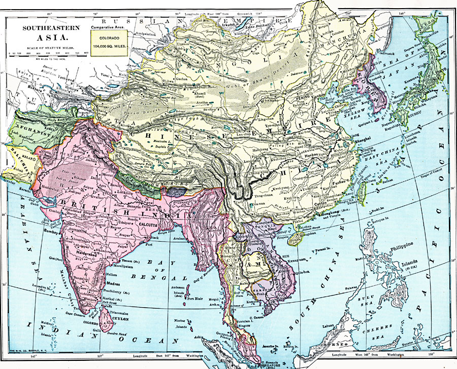
Description: A map from 1906 of Southeast Asia showing the political boundaries at the time, including the Chinese Republic, the Japanese Empire (including Korea and Formosa or Taiwan), the extent of British India (including Baluchistan and Burma) and French Indo–China (including Tonkin, Annam, Cochin China, and Cambodia). The map shows province boundaries, capitals and major cities, mountain systems, plateaus, deserts, rivers, coastal features, and islands of the region. An outline map of Colorado at the same map scale is included to show comparative area size.
Place Names: Miscellaneous Asia, Afghanistan, �Baluchistan, �British India, �Burma, �China, �Hong Kong, �Korea, �Malay Peninsula, �Siam,
ISO Topic Categories: oceans,
inlandWaters,
location,
boundaries
Keywords: Southeastern Asia, borders, �topographical, �physical, kComparativeArea, physical features,
topographical,
geological, country borders, oceans,
inlandWaters,
location,
boundaries, Unknown, 1899
Source: Horace S. Tarbell, LL.D. , The Complete Geography (New York, NY: American Book Company, 1899) 112
Map Credit: Courtesy the private collection of Roy Winkelman |
|