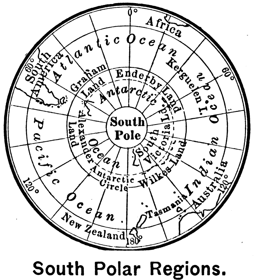
Description: A map of the Antarctic region from 1899 showing the South Pole and Antarctic Circle, Graham Land, Enderby Land, South Victoria Land, Wilkes Land, and Alexander Land. The map illustrates how unknown the continent was at the time by the fact that an Antarctic Ocean is shown within the Antarctic Circles, presuming a situation similar to the Arctic Ocean at the North Pole.
Place Names: Antarctic Region, Davis (Australia), �Dumont dUrville (France), �Maitri (India), �Mcmurdo (U.S.), �Mostok (Russia), �Neumayer (Germany), �Orcadas (Argentina), �Sanae IV (South Africa), �Syowa (Japan), �Zhong Shan (China
ISO Topic Categories: oceans,
location
Keywords: South Polar Region, physical, � physical features, oceans,
location, Unknown, 1899
Source: Horace S. Tarbell, LL.D. , The Complete Geography (New York, NY: American Book Company, 1899) 132
Map Credit: Courtesy the private collection of Roy Winkelman |
|