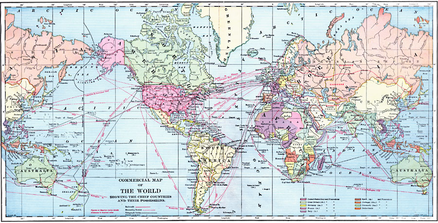
Description: A map of the world from 1899, color–coded to show the chief countries of the world and their possessions at the time, including the United States, Great Britain, Germany, France, Italy, Spain, Portugal, Denmark, and Netherlands. The map shows major railways, canals, steamer ship routes with distances between ports given in nautical miles, and submarine telegraph lines.
Place Names: A Complete Map of Globes and Multi-continent, Australia, �Africa, �Antarctica, �Asia, �Europe, �North America, �South Americ
ISO Topic Categories: oceans,
inlandWaters,
location,
boundaries
Keywords: Commercial Map of the World showing the Chief Countries and their Possessions, borders, �topographical, �physical, �railroads, �transportation, kEconomic, physical features,
topographical,
geological, country borders, railroads,
water routes, oceans,
inlandWaters,
location,
boundaries, Unknown, 1899
Source: Horace S. Tarbell, LL.D. , The Complete Geography (New York, NY: American Book Company, 1899) 144-145
Map Credit: Courtesy the private collection of Roy Winkelman |
|