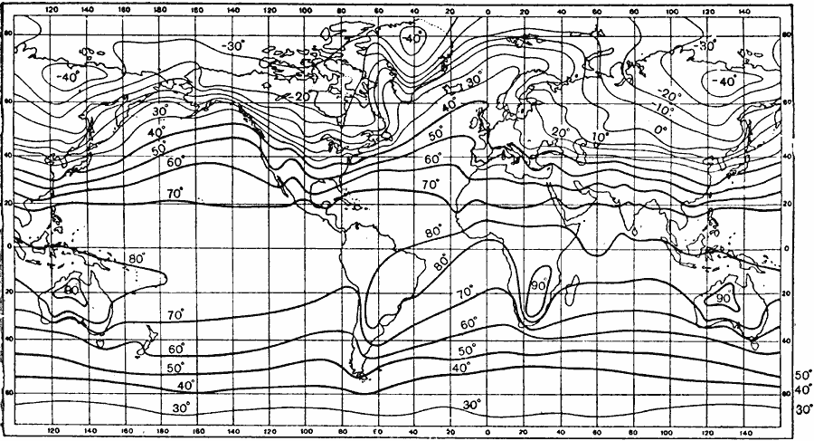
Description: An isothermal chart of the world from 1915 showing typical temperature patterns for the month of January. Temperatures are shown on the isotherms, given in degrees Fahrenheit.
Place Names: A Complete Map of Globes and Multi-continent, Africa, �Asia, �Australia, �Europe, �North America, �South Americ
ISO Topic Categories: climatologyMeteorologyAtmosphere,
oceans
Keywords: January Isotherms, physical, �meteorological, kClimate, physical features, temperature, climatologyMeteorologyAtmosphere,
oceans, Unknown, 1915
Source: Graeme Williams, ed., The World We Live In (London, England: Waverley Book Company, LTD, 1915) 169
Map Credit: Courtesy the private collection of Roy Winkelman |
|