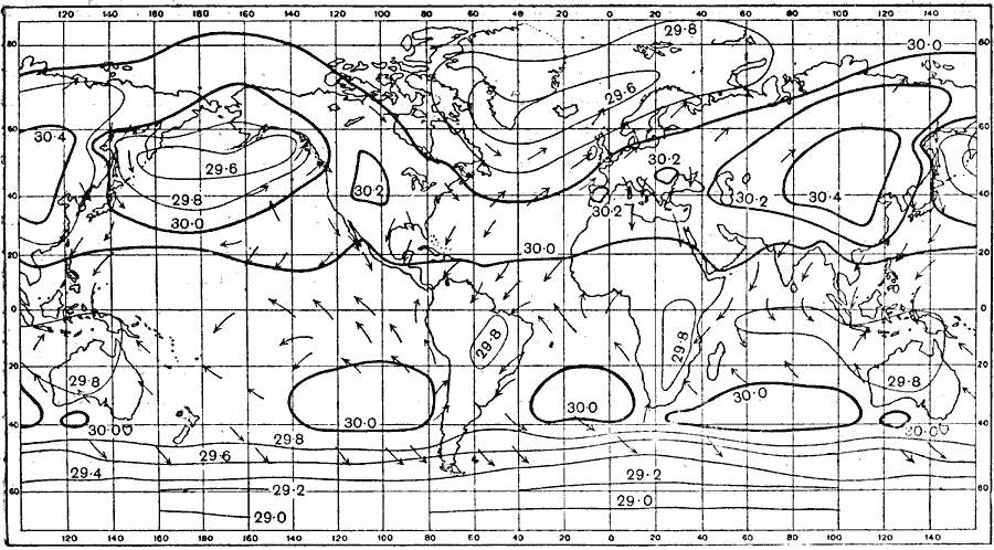
Description: A world map from 1915 showing typical global isobars and winds during January. Barometric pressures are shown on the isobar lines. Typical wind directions are shown flying with the arrowheads, away from high pressure and towards low pressure areas.
Place Names: A Complete Map of Globes and Multi-continent, Africa, �Asia, �Australia, �Europe, �North America, �South Americ
ISO Topic Categories: climatologyMeteorologyAtmosphere,
oceans
Keywords: January Isobars and Wind Direction, physical, �meteorological, kClimate, physical features, climate, climatologyMeteorologyAtmosphere,
oceans, Unknown, 1915
Source: Graeme Williams, ed., The World We Live In (London, England: Waverley Book Company, LTD, 1915) 175
Map Credit: Courtesy the private collection of Roy Winkelman |
|