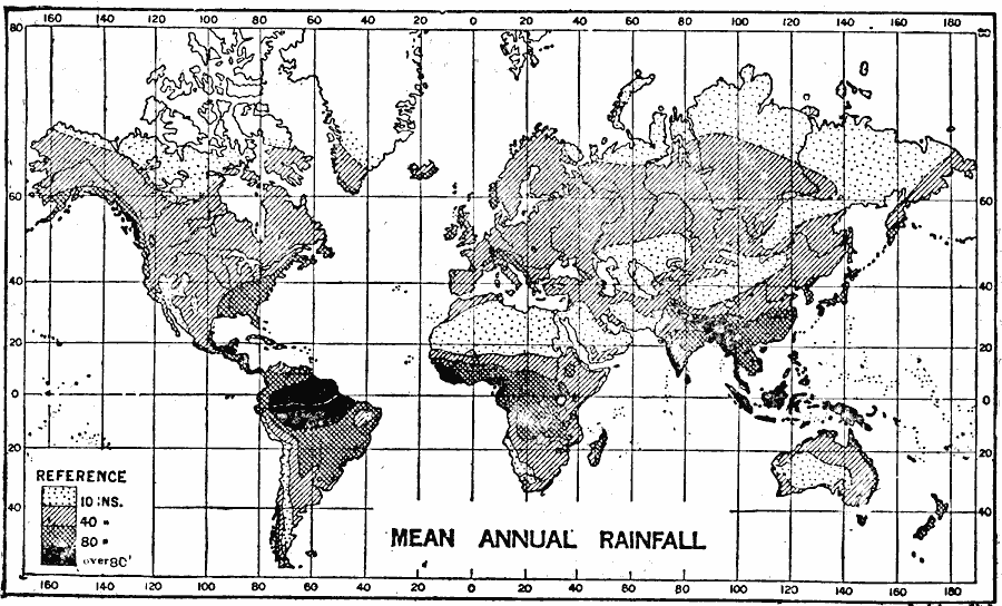
Description: A world map from1915 showing mean annual rainfall across the earth. The map is shade–coded to show regions where mean annual rainfall is 10 inches or less in light stippling, up to 40 inches in light gray, up to 80 inches in dark gray, and over 80 inches in black.
Place Names: A Complete Map of Globes and Multi-continent, Africa, �Asia, �Australia, �Europe, �North America, �South Americ
ISO Topic Categories: climatologyMeteorologyAtmosphere,
oceans
Keywords: Worldwide Mean Annual Rainfall, physical, �meteorological, kClimate, physical features, rainfall, climatologyMeteorologyAtmosphere,
oceans, Unknown, 1915
Source: Graeme Williams, ed., The World We Live In (London, England: Waverley Book Company, LTD, 1915) 183
Map Credit: Courtesy the private collection of Roy Winkelman |
|