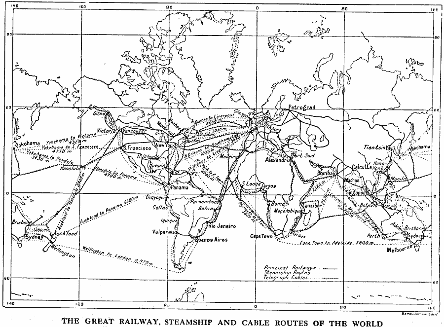
Description: A world map from 1915 showing principal railways, steamship routes with distances between ports given in nautical miles, and submarine telegraph cable routes at the time.
Place Names: A Complete Map of Globes and Multi-continent, Africa, �Antarctica, �Asia, �Australia, �Europe, �North America, �South America, �Yokohama, �Sydney, �Auckland, �Wellington, �Victoria, �Sitka, �Honolulu, �Valparaiso, �Panama, �San Francisco, �Montreal, �New York, �New Orleans, �Rio Janeiro, �Buenos A
ISO Topic Categories: location,
oceans,
inlandWaters,
transportation,
utilitiesCommunication
Keywords: World Railway, Steamship and Submarine Telagraph Cable Routes, physical, �political, �transportation, physical features, railroads,
water routes, location,
oceans,
inlandWaters,
transportation,
utilitiesCommunication, Unknown, 1915
Source: Graeme Williams, ed., The World We Live In (London, England: Waverley Book Company, LTD, 1915) 189
Map Credit: Courtesy the private collection of Roy Winkelman |
|