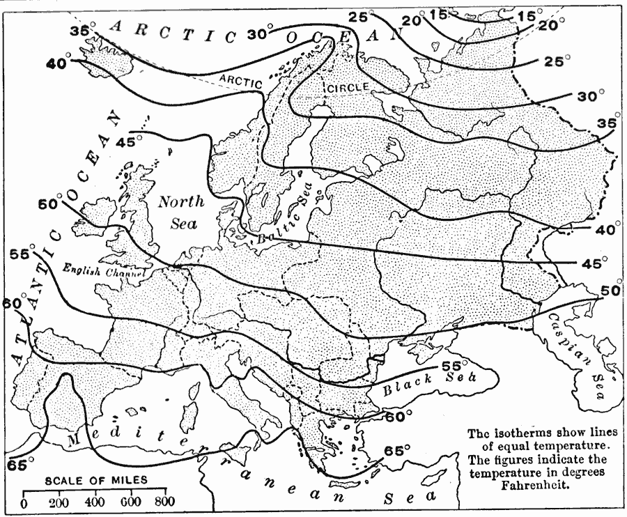
Description: An isothermal map of Europe from 1916 showing the average temperature ranges on the continent, illustrating how the westerly winds bring the temperatures of the ocean far inland. The isotherms show lines of equal temperature in degrees Fahrenheit.
Place Names: A Complete Map of Europe,
ISO Topic Categories: boundaries,
oceans,
location,
inlandWaters,
climatologyMeteorologyAtmosphere
Keywords: Isothermal Map of Europe, physical, �political, �meteorological, kClimate, physical features, country borders, temperature, boundaries,
oceans,
location,
inlandWaters,
climatologyMeteorologyAtmosphere, Unknown, 1916
Source: Albert Perry Brigham & Charles T. McFarlane, Essentials of Geography (New York, NY: American Book Company, 1916) 378
Map Credit: Courtesy the private collection of Roy Winkelman |
|