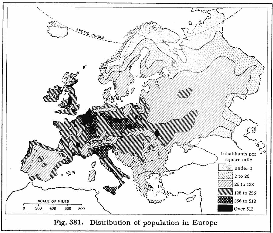
Description: A 1916 map showing the distribution of population in Europe as inhabitants per square mile.
Place Names: A Complete Map of Europe,
ISO Topic Categories: boundaries,
location,
oceans,
inlandWaters,
society
Keywords: European Population Density, physical, �political, �statistical, kPopulation, physical features, country borders, population, boundaries,
location,
oceans,
inlandWaters,
society, Unknown, 1916
Source: Albert Perry Brigham & Charles T. McFarlane, Essentials of Geography (New York, NY: American Book Company, 1916) 269
Map Credit: Courtesy the private collection of Roy Winkelman |
|