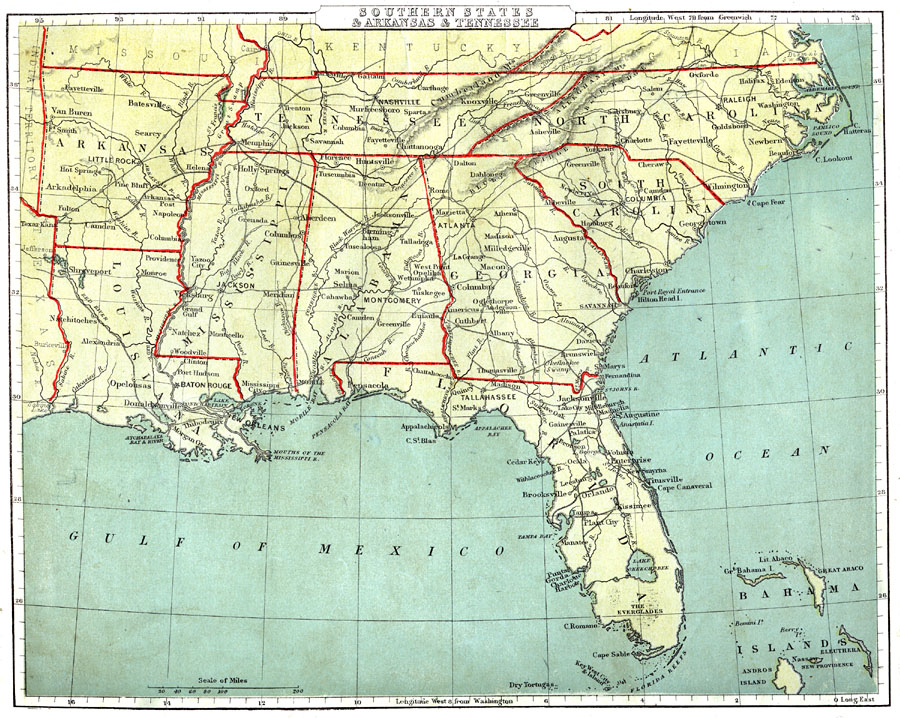
Description: Southern states of the United States.
Place Names: Southern States, Tampa, �Brooksville, �Jacksonville, �Atlanta, �Columbus, �Charleston, �Columbia, �Georgetown, �Wilmington, �Fayetteville, �Raleigh, �Halifax, �Oxford, �Asheville, �Knoxville, �Nashville, �Murfreesboro, �Chattanooga, �Huntsville, �Aberdeen, �Montgomery,
ISO Topic Categories: boundaries,
inlandWaters,
location,
oceans,
transportation
Keywords: Southern States, physical, �political, �transportation, physical features, major political subdivisions, railroads, boundaries,
inlandWaters,
location,
oceans,
transportation, Unknown, 1888
Source: , Cornell's Intermediate Geography (New York, NY: American Book Company, 1888) 29
Map Credit: Courtesy the private collection of Roy Winkelman |
|