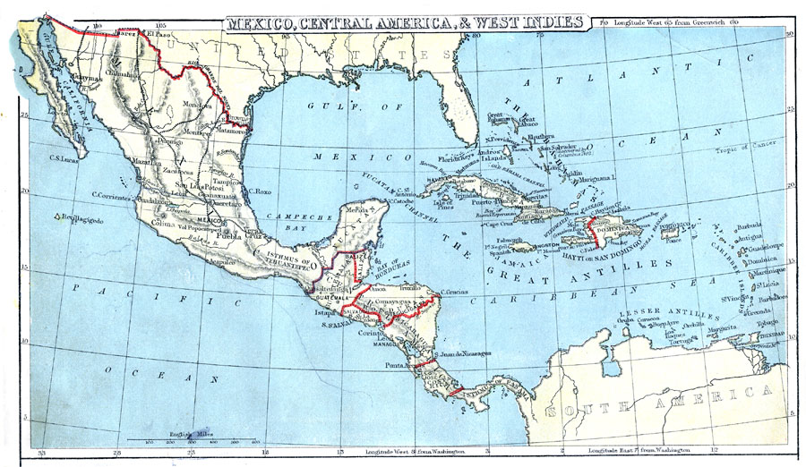
Description: A map from 1888 of Mexico, Central America, and the West Indies showing the political boundaries at the time, capitals and major cities, railways, mountain systems, coastal features, reefs, and islands of the region.
Place Names: A Regional Map of North America, Mexico, �Yucatan, �Guatemala, �Balize, �Salvador, �Honduras, �Nicaragua, �Costa Rica, �Isthmus of Panama, �Cuba, �Jamaica, �Hayti, �Dominica, �Porto Rico, �Trinida
ISO Topic Categories: boundaries,
inlandWaters,
location,
oceans,
transportation
Keywords: Mexico, Central America, West Indies, physical, �political, �transportation, kCaribbean, kCentralAmerica, physical features, country borders, railroads, boundaries,
inlandWaters,
location,
oceans,
transportation, Unknown, 1888
Source: , Cornell's Intermediate Geography (New York, NY: American Book Company, 1888) 50
Map Credit: Courtesy the private collection of Roy Winkelman |
|