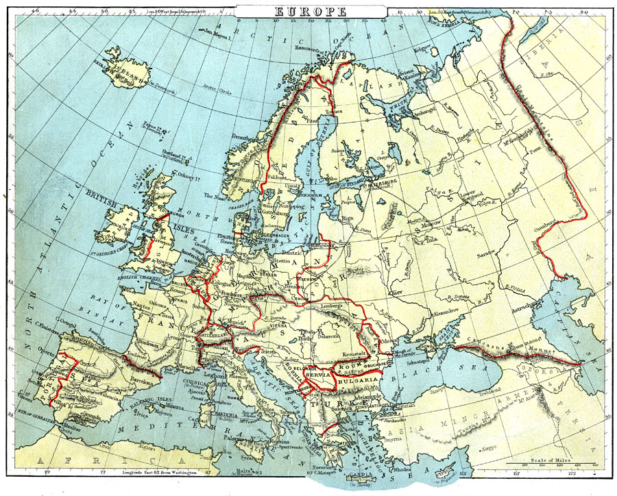
Description: A map showing country boundaries of Europe as they existed in 1888, including major cities, rivers, and landforms. This map highlights the significance of the use of natural boundaries (rivers and mountains) over cadastral (surveyed or lat/long lines) for determining country borders such as the Krolen Mountains between Norway and Sweden, Ural Mountains between Russia and Asia, Caucasus Mountains between Russia and Asia Minor, the Pyrenees between France and Spain, and the Danube River between Romania and Bulgaria.
Place Names: A Complete Map of Europe, Sweden, �Norway, �Ireland, �Scotland, �England, �France, �Spain, �Portugal, �Belgium, �Holland, �Italy, �Switzerland, �German Empire, �Denmark, �Austria, �Poland, �Servia, �Montenegro, �Turkey, �Greece, �Roumania, �Finlan
ISO Topic Categories: boundaries,
inlandWaters,
location,
oceans
Keywords: Europe, physical, �political, kNaturalCadastralBoundaries, physical features, country borders, boundaries,
inlandWaters,
location,
oceans, Unknown, 1888
Source: , Cornell's Intermediate Geography (New York, New York: American Book Company, 1888) 58
Map Credit: Courtesy the private collection of Roy Winkelman |
|