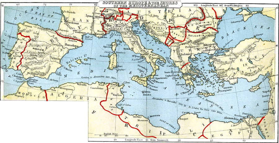
Description: A map from 1888 of southern Europe and the shores of the Mediterranean showing the countries of Portugal, Spain, portions of France, Switzerland, Italy, portions of Austria, Montenegro, Servia, Roumania, Greece, and Turkey in Europe. This map shows major cities, rivers, mountain systems, and the sailing routes and distances between major ports.
Place Names: Mediterranean Europe, Portugal, �Spain, �France, �Switzerland, �Italy, �Austria, �Roumania, �Servia, �Turkey, �Greece, �Sardini
ISO Topic Categories: boundaries,
inlandWaters,
location,
oceans,
transportation
Keywords: Southern Europe and Mediterranean Shore, physical, �political, �transportation, physical features, country borders, railroads, boundaries,
inlandWaters,
location,
oceans,
transportation, Unknown, 1888
Source: , Cornell's Intermediate Geography (New York, NY: American Book Company, 1888) 62
Map Credit: Courtesy the private collection of Roy Winkelman |
|