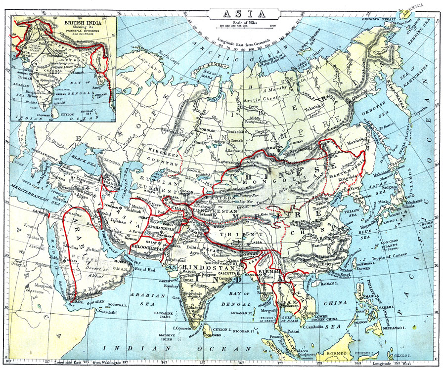
Description: A map of Asia from 1888 showing country boundaries at the time, capitals and major cities, rivers, canals, lakes, deserts, terrain, and coastal features. The major political divisions shown on this map are Siberia and the Russian Empire territories of Kirgheez Country and Russian Turkestan, the Chinese Empire, including Mongolia, Mantchooria (Manchuria), Corea (Korea), China Proper, and Thibet (Tibet), India, including Hindostan, Assam, Birmah (Myanmar), Siam (Thailand), and Anam (Vietnam), the Turkish Ottoman Empire, Arabia, Persia, Beloochistan, Afghanistan, Bokhara, and the Empire of Japan. An inset map details British India, showing its principal political divisions and railroads. The map shows longitude from Greenwich at the top of the map, and longitude from Washington at the bottom.
Place Names: A Complete Map of Asia, Arabia, �Persia, �Beloochistan, �Afghanistan, �Bokhara, �Hindostan, �Thibet, �Chinese Empire, �Burmah, �Anam, �Siam, �Mantchooria, �Turke
ISO Topic Categories: boundaries,
inlandWaters,
location,
oceans
Keywords: Major Political Divisions of Asia., physical, �political, physical features, country borders, boundaries,
inlandWaters,
location,
oceans, Unknown, 1888
Source: , Cornell's Intermediate Geography (New York, NY: American Book Company, 1888) 75
Map Credit: Courtesy the private collection of Roy Winkelman |
|