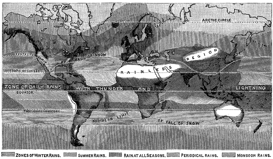
Description: A Hyetographic or rain map of the world from 1888. This map is shading–coded to show zones of winter rains, summer rains, rains at all seasons, periodical rains, monsoon rains, and rainless regions. The map shows the northern and southern limits of snowfall, the equatorial zone of daily rains with thunder and lightning, and the latitudes of the Arctic Circle and tropics of Cancer and Capricorn.
Place Names: A Complete Map of Globes and Multi-continent,
ISO Topic Categories: climatologyMeteorologyAtmosphere,
inlandWaters,
oceans
Keywords: Rain Map of the World, physical, �meteorological, kClimate, physical features, climate,
rainfall, climatologyMeteorologyAtmosphere,
inlandWaters,
oceans, Unknown, 1888
Source: , Cornell's Intermediate Geography (New York, New York: American Book Company, 1888) 91
Map Credit: Courtesy the private collection of Roy Winkelman |
|