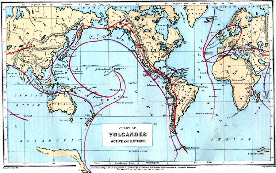
Description: A map from 1885 showing the regions of active and extinct volcanic activity across the earth. The map shows prominent volcanoes with names underlined in red, regions of volcanic activity such as The Great Volcanic Circle (Ring of Fire) of the Pacific, and shows the extent of seismic activity caused by the Earthquake of Lisbon (November 1, 1755).
Place Names: A Complete Map of Globes and Multi-continent, Asia, �North America, �South America, �Greenland, �Europe, �Africa, �Australi
ISO Topic Categories: geoscientificInformation,
inlandWaters,
location,
oceans
Keywords: Chart of Volcanoes, Active and Extinct, physical, �political, physical features, geoscientificInformation,
inlandWaters,
location,
oceans, Unknown, 1885
Source: M. F. Maury, Physical Geography (New York, New York: University Publishing Company, 1885) 19
Map Credit: Courtesy the private collection of Roy Winkelman |
|