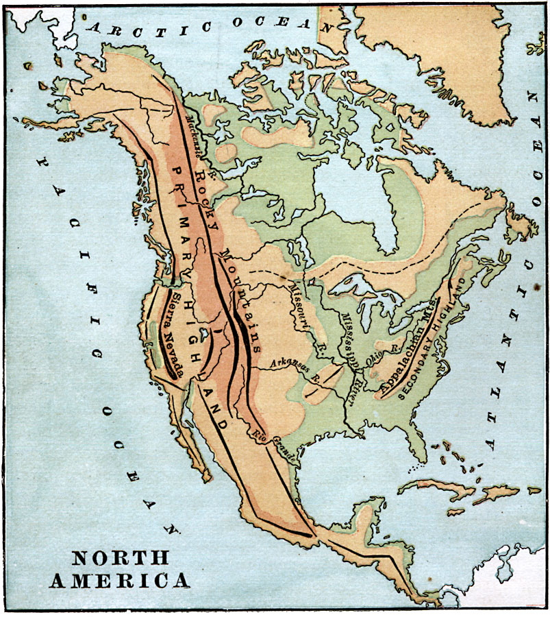
Description: A map from 1885 of North America and Central America showing the major relief features of the region. The map shows the primary highland known as the Pacific Highland, with the Sierra Nevada and Rocky Mountains, the secondary highlands with the Appalachian Mountains, the Great Central Plain with the narrow ridge running east to west marked with a dashed line indicating the drainage divide for rivers flowing to the Atlantic and rivers flowing to Hudson Bay and the Arctic Ocean. The Mackenzie, Missouri, Arkansas, Mississippi, Ohio, and Rio Grande rivers are shown. "The heavy black lines upon the maps represent, in a general way, the extent and direction of the mountain chains. They are indicated also by the buff and green colors on the maps. The buff, according to the depth of its tint, represents elevations of greater or less altitude. The green represents lowlands." — Maury, 1885, p. 30.
Place Names: A Complete Map of North America, North America, �Sierra Nevada, �Appalachian Mountain
ISO Topic Categories: elevation,
inlandWaters,
location,
oceans
Keywords: North America, physical, kOrographic, physical features,
topographical, elevation,
inlandWaters,
location,
oceans, Unknown, 1885
Source: M. F. Maury, Physical Geography (New York, NY: University Publishing Company, 1885) 30
Map Credit: Courtesy the private collection of Roy Winkelman |
|